

Flood Ready
Flood Ready Vermont contains information and resources regarding flooding and proactive steps to take to become flood resilient. They provide information on natural flood protection (river corridors and forest cover) as well as information on improving infrastructure (culverts, roads, and weakened buildings).
For more information on Flood Ready or other resources related, visit the State of Vermont Flood Ready site.
Flood Training
In conjunction with the Vermont Flood Ready page, the State of Vermont Flood Training tool is a proactive tool to train local select board members, planning commission membmers and town officials in order to make our towns more resilient. Its three training sections include understanding river corridors and the effects of flooding on our land, case studies of towns that used proactive management to prevent flooding along river corriors an floodplains, and providing tools to assist our own communities.
ANR River Corridor Maps
The Agency of Natural Resources has posted the Vermont Flood Ready Atlas, an online tool which can be used to locate areas in danger of flooding. The Flood Ready page also includes some information on how to use the online tool.
River Corridors
What they are: A river corridor is delineated to provide for the least erosive form toward which a river will evolve during floods over time. A river corridor includes the river channel as well as a buffer zone on land of 50 feet. This additional space is necessary as the water flow shifts and water levels rise. Infrastructure within the river corridor boundaries have a higher chance of being affected by erosion and flooding due to the natural changes in the environment. By protecting large and broad corridors along rivers with a “meandering” path, rivers tend to be more stable, and dramatic shifts and accelerated erosion is less likely to happen. River corridor maps guide State actions to protect, restore, and maintain naturally stable meanders and riparian areas to minimize erosion hazards. Land within and immediately abutting a river corridor may be at higher risk to fluvial erosion during floods.
What they are not: River Corridor Maps do not indicate any required action on the part of municipalities. They are developed to facilitate ANR’s responsibilities in Act 250 to protect public safety from fluvial erosion hazards and to regulate activities exempt from municipal regulation under the Flood Hazard Area and River Corridor Rules. The Legislature has directed the ANR to promote municipal river corridor protection, but towns are not required, nor does the state have the authority to require the use of these maps by local communities. Landowners are not required to get flood insurance within Mapped River Corridors.
Over time, this newly posted map will serve as a place to composite data from the hundreds of separate river corridor and fluvial erosion hazard mapping exercises that have been conducted by our local and regional partners since 2004. The Base Map is a computer modelling product that will eventually incorporate both existing and new field-based stream geomorphic data (e.g., it does not yet reflect all those places where bedrock confines the stream channel). The ANR Rivers Program welcomes the opportunity to work directly with municipal and regional planning commissions in this process to ensure that the Statewide River Corridor Layer becomes a meaningful flood resiliency planning tool.
Two documents are attached;
- ANR Releasing River Corridor Base Map:
gives background information on why the state has generated a statewide map, provides links to other river corridor and flood hazard mitigation planning information, and list the local data that may yet be incorporated to build a robust Statewide River Corridor Layer. - Reviewing the River Corridor Base Map:
explains the types of map refinements the ANR is hoping to make before posting the Statewide Map on the ANR Natural Resource Atlas early in the new year and how people may participate in that process.
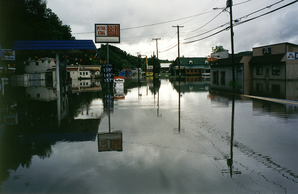
Flooding along Broad St in Lyndonville (Route 5).
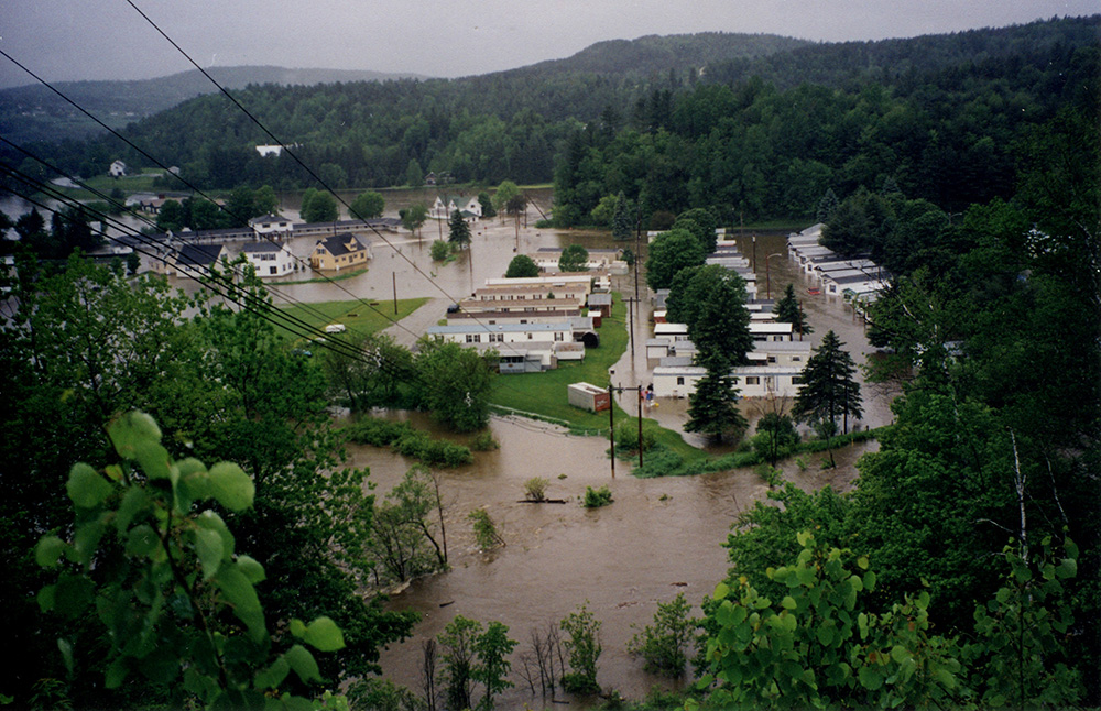
Trailer Park at junction of Routes 5, 114, and 122.
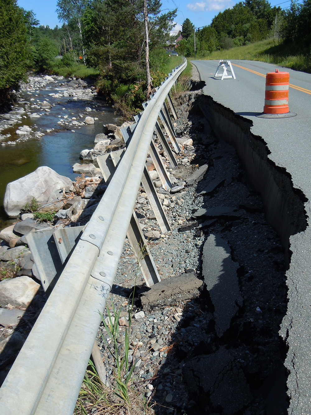
Bridge damage due to river flooding.
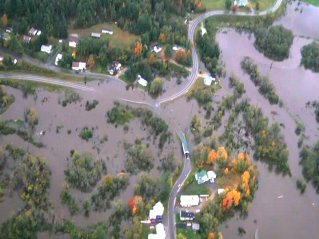
Overhead view.