

Watersheds > Upper Connecticut Drainage Basin
-
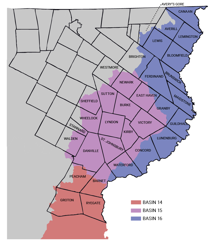
Basin 14 — Steven, Wells, Waits, Ompompanoosuc, Connecticut
Basin 14 covers the are with the Wells River, Waits River, Ompompanoosuc River, and Stevens River. One of the main stressors is physical shifts to the environments like erosion and flow alteration. Dams and hydro facilities have been the sources of flow alteration in the Wells River and Stevens River, and. Toxins and nutrient loading are other stressors affecting the local water quality. Nutrient loading has affected Ticklenaked Pond and a tributary of Tabor Branch through agriculture runoff, and other various water sources have been polluted by acid and metals by drainage from abandoned mines.
Projects targeted at the area:
— Re-establishing post-closure care at Newbury Landfill to prevent pollution from drainage
— Continuing reducing phosphorus levels in Ticklenaked Pond
— Acid rock cleanup in Ely Copper Mine
— High E. coli concentrations in Ompompanoosuc River
Additional Information:
-
Basin 15 — Passumpsic
Basin 15 covers the East and West Branches of the Passumpsic River, as well as Sleepers River, Millers Run, and Joes Brook. Like the Upper Connecticut Basin, there are sections of the watershed affected by pathogens and nutrient loading, primarily along the southern section of the basin in Moose River, Sleepers River, and the main portion of the Passumpsic River south of Lyndon. However, the main stressors throughout the basin are land and channel erosion as well as encroachment.
Projects targeted at the area:
— Better Backroads project on Mooney Road in St. Johnsbury, Vermont
— Stormwater and sediment mitigation project scoping in Dish Mill Brook Watershed
— Illicit Discharge Detection and Elimination (IDDE) project for St Johnsbury
— Passumpsic River bridge and culvert assessment
Additional Information:
-
Basin 16 — Upper Connecticut
Basin 16 covers the northern section of the Connecticut River as well as the Nulhegan River and Paul Stream. Some of the main stressors in this area are pathogens and nutrient loading. The main pathogen found was E. coli, targeted mostly in swimming holes along the Upper Connecticut River. The primary sources of nutrient loading are atmospheric deposition (air and precipitation deposits) and agriculture, which causes excess amounts of nitrogen to accumulate in the local water sources.
Projects targeted at the area:
— Johnson Farm WMA conservation and floodplain restoration project
— Floodplain protection and restoration along Connecticut River, primarily in Canaan and Maidstone
— Vermont Fish and Wildlife/Trout Unlimited habitat restoration project along the East Branch Nulhegan River
Additional Information: